Mount Everest New Height- World Tallest Mountain gain 0.86 Meters.
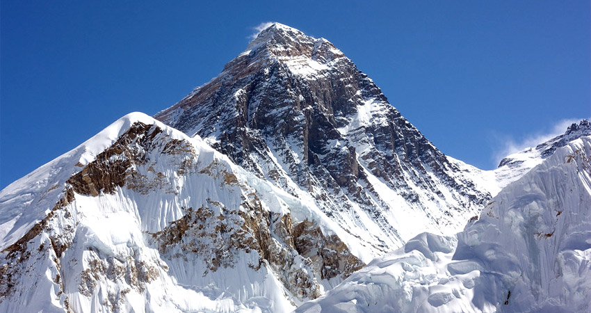
Mount Everest’s new height is known worldwide for its height as it is the world’s highest mountain. Mt Everest lies at the border of Nepal and China. Before 2020, the actual height of Mount Everest was 8,848 sq. km. However, after the survey, which was held on 8 December 2020, Nepal and China both jointly announced that Mount Everest’s height had been increased by 0.86 meters, which is almost a meter. So Mount Everest’s New Height is 8,848.86 sq. km.
Mount Everest’s new height was announced on Nepal’s national television. Susheel Dangol, Ne, Pal’s chief survey officer, stated, “We can be confident that this is the most accurate height of Everest we have ever had.” He also said that it is a massive responsibility on our part as a country of Mount Everest and a movement of pride for all of us. Measuring the world’s highest peak is a big deal, so since 2018, Nepal has been measuring Mount Everest.
Meanwhile, several teams have offered new techniques for measuring Mount Everest’s new height. Nepal wanted to do this survey alone, but China also participated after Chinese President Xi Jinping visited Nepal. It is said to be the most accurate height till now. Nepal and China’s joint effort has calculated Mount Everest’s new height. Four Nepal surveyors spent two years training for this mission before going to the summit. The Nepalese team went to surrender for the survey in May of 2019. And the Chinese team went right after that.
Mount Everest’s old height
We all know Mount Everest’s old height is 8,848 square kilometers. Between 1849 and 1855, a survey was conducted in India to measure the height of Mount Everest. This survey was conducted in Dehradun; Triangulation was done from the India base to the Sonakhoda base in Bihar. Mount Everest was also observed using this method. But during that time, people didn’t know that Mount Everest was the highest point in the world. After the survey competition, Mount Everest’s height was 8,839.80 meters. Later, in 1945, another survey was held to measure the height of Mount Everest from India.
This survey was done in Bihar, India, using the trigonometric method. They identified the actual height of Mount Everest as 8,848 square meters. Km. After that, many surveys were conducted in different countries using new techniques, but these were not accepted. Nepal has not been part of any survey to measure the height of Mount Everest, but since 2018, Nepal has built a survey team to measure the height. In 1999, an American team did another study measuring Mount Everest’s height.
They used a GPS (global positioning system). They estimate the height of Mount Everest to be 8,850 meters. This height was accepted by many specialists in geodesy and cartography. However, Nepal also welcomed the revelation it kept using the height determined in 1945. Not only Nepal, but before the new height of Mount Everest was established in Nepal, everyone thought the world used the same height.
Measurement of Mount Everest’s new height
There are many ways of measuring Mount Everest’s new height. The mean sea level is always considered the base for measuring mountains. So, while measuring the height of mountains, the main work is at the bottom rather than at the top. Nepal has used the Bay of Bengal as the mean sea level to measure other mountains.
In the case of Mount Everest’s new height, India has already surveyed a point closer to Everest, near the border of Nepal and India, so Nepalese surveyors used that point as a mean sea level. After identifying the mean sea level, surveyors built a network of lines of sight, creating a chain up to 250 km or any other point from where Everest is visible.
Meanwhile, Chinese surveyors used separate mean sea levels as their base. They used the province of Shandong as the mean sea level. Surveyors from both countries used the trigonometry formula to calculate the new height of Mount Everest. Using the formula, they calculated Mount Everest’s new triangle height by multiplying its base with the angles. To measure the top of the mountain, someone must be at the top of Mount Everest’s new height. So, Nepalese surveyors went up to the summit last year.
Nepalese surveyors used 12 different lower peaks near Everest for trigonometric calculation. They also said that these 12 peaks helped achieve the precise result. On the other hand, Chinese surveyors also used the same method and formula. Associated researcher of a Chinese academy of survey and mapping had stated that “surveyor’s beano had been placed on the summit, surveyors who were at the station around the Everest measured the distance from the six-point to the bacon, and at least six triangles can be calculated to determine the Mount Everest new height.
Why did the height of Mount Everest change?
The first survey of Mount Everest’s new height was held in 1975, and the second in 2005. During the second survey, the Chinese team installed a Chinese version of a GPS device on Mount Everest. China invented the BeiDou navigation satellite system, which is known to be the rival of US-owned GPS (global positioning system). China used the same device to measure the height of Mount Everest, whereas Nepalese surveyors used the actual GPS to measure the submit. GPS is a more precise instrument, so Nepalese surveyors used GPS.
For many years, various countries have debated whether it should be “rock height” or whether the snow cladding should also be added to the height.
Nepal and China used GPS (global navigation satellite) systems to calculate the altitude data from various surveyors. China has conducted two surveys to measure Mount Everest’s height until now.
Mount Everest’s new height has been changed from 8,848 sq. km to 8,848.86 sq. km. There are several reasons for this. Many specialists and scientists have said the ongoing impact with Eurasia might force the mountains to a greater height than Mount Everest.
The rocks of the mountains continue to rise toward the skies; erosion works against their upward progression. No one can force or do anything artificially to change Mount Everest’s new height. The change in height of Mount Everest is a natural process. Different reasons affected the new height of Mount Everest. Here are the reasons
GEOLOGICAL UPS AND DOWNS for Mount Everest’s new height
Geological ups and downs have played a vital role in changing the height of Mount Everest. A massive earthquake hit Nepal in 2015, and since then, the tectonic plates of nearby mountains have been moving. The movement of tectonic plates helps to lift the mountain. The balancing fore can help to maintain a degree of stability over time.
A member of a Chinese team that surveyed Everest’s height stated in a report that nature tends to strike a balance. He gave the example of Dang, citing a massive earthquake in 1934 that wiped out 150 years of steady height increase due to the movement of the tectonic plate.
MEASURING MOUNTAINS for Mount Everest’s new height
There are different ways to establish the height of any mountain. However, the Chinese team used a different type of GPS and other equipment. On the other hand, the Nepalese squad did the same procedure with additional equipment. The equipment used by the Nepalese team is believed to be more precise and usable compared to the equipment used by the Chinese team. They also used a laser-equipped version of a theodolite. The Nepalese team used a ground-based radar to achieve the amount of snow and ice on the top of Mount Everest.
HAWAII’S UNDERWATER GIANT
The essential thing to do before measuring the height of Mount Everest is to establish the mean sea level. The main work while measuring Mount Everest is to be done in the bottom rather than the top area. The mountain along the equator is farther from the earth’s core in the middle.
Some frequently asked questions about Mount Everest’s new height
What was the methodology?
During a webinar, the foreign minister of Nepal, Pradeep Kumar Gyawali, and the foreign minister of China, Yang Yi, announced Mount Everest’s new increased height. They did not provide any particular details about the methodology used to measure the new height. The secretary and spokesperson for Nepal’s Department, Surveyor Dhakal, stated that we had used the previous method to acquire the height from the Global Navigational Satellite System (GNSS). Both Nepalese and Chinese data showed accuracy.
Why the difference in official height?
There have been lots of arguments about the height of Mount Everest. Earlier, the Chinese surveyors had calculated the height of the mountain in 2005. Afterward, in an interview with BBC Nepal, the government stated that they were under pressure from China to accept the new height, which China calculated.
After that, the Nepal government also said it had decided to go for a fresh measurement to set the actual height once and for all. After that, china also became a part of this survey. Since Mount Everest falls on the border of Nepal and China, both countries have jointly surveyed to find out.
Many countries have been conducting surveys to determine the height of Everest since a devastating earthquake hit Nepal in April 2015. Before that, the Nepal survey department had never considered measuring Mount Everest, but after the quake, disputes arose among different stakeholders on whether the earthquake affected the height.
Then, Nepal formed a team to measure Mount Everest’s height. The surveyor also underwent two years of training to learn the techniques of measuring Mount Everest. In 2018, the team measured Mount Everest’s height.
Did China do the survey separately to get Moune Everest’s new height?
China has done three surveys to measure the actual height of Mount Everest. However, Nepal and other countries did not accept the first two attempts. When Nepal was doing the study, Chinese President Xi Jinping visited Nepal.
After that, China also wanted to survey Mount Everest to establish the new height. Both Nepal and China started doing surveys separately. Nepal completed its mission in early 2019, but China was beginning it. The team of 120 surveyors processed the data and computed results, but the work was delayed due to the coronavirus pandemic. Then, China and Nepal signed a memorandum of understanding to publicize the result.
Could there be any disagreement on the method or the equipment used during the process?
Many disagreements may arise regarding the process or the outcomes. However, since this survey is said to be the most accurate and precise result, there should not be any disagreement. The national department of the survey has reported that although the survey was done from two different sides, the result and the accuracy of the methods appear to be the same.
This is an essential takeaway for Nepal. Mount Everest’s new height is a movement of national pride and achieving the technological feat.
The senior officer of the surveying department said that Nepal is first involved in ascertaining the height of the mountains, which link to our identity. He also said that the world and those people who come to Nepal to see Mount Everest will be able to gain a higher record by climbing Mt. Everest, which is taller than yesterday.
Book with Confidence
- Flexible bookings and easy trip date changes
- Personalized service and customized group sizes
- Safe travels with owner-operated services and highly experienced guides
- Best price guarantee for the most value for your money
- Secure & easy online booking
 Have Questions?
Talk to Expert
Meet Mr. Puru Timalsena, Nepal's best trek and tour organizer, who has been working in the Himalayas for more than 15 years.
WhatsApp/Viber +977 98510 95 800