Nepal Launches New Map – Kalapani, Lipulekh, Limpiyadhura

A new map of Nepal includes Kalapani, Lipulekh, and Limpiyadhura. The border disputes related to Kalapani, Lipulekh, and Limpiyadhura are now approaching a conclusion after the Nepal government exposed a new map. The extended border disputes, rooted in 1864 AD, could not be concluded successfully despite various meetings.
Nepalese have always dreamt of a greater Nepal, as our most outstanding leaders have fought to make one united Nepal.
On May 18, 2020, the government of Nepal published its new map of Nepal with its political map, including these three states, which are the property of Nepal but were never officially included in the map. Minister for Land Management, Cooperatives, and Poverty Alleviation Padma Aryal exposed the map during a press meeting on May 18, 2020.
According to the updated map, these territories lie in Byas Rural Municipality of Darchula District, Sudurpaschim Province. After adding this conflicted territory India initially occupied, Nepal’s total area increased to 147,516 square kilometers. Before this, it was 147,181 square kilometers. These territories consist of Gunji, Navi, and Kuti, which lie near Kalapani. This new official map will be used soon.
We all are very proud of the vital decision of the Nepal government. Nepal Launches a New map of Nepal, including Kalapani, Lipulekh, and Limpiyadhura, on May 18, 2020. Many experts have given their strong statements regarding these issues. However, some Indian media outlets are expressing objections to this issue. They are unaware of the facts and the Sugauli treaty in AD 1816.
New maps of Nepal include the Limpiyadhura also.
These north-western territories (Kalapani, Lipulekh, Limpiyadhura) have created a long-term headache for Nepal, as both sides claim to be their own. However, based on the Sugauli treaty done in 1864 AD proves that these territories belong to Nepal.
This revolutionary decision of Nepal was triggered after India inaugurated road construction, which passed through these territories without Nepal’s consent. On May 12, 2020, India started the 79-km road to Manasarover that passes through these disputed areas(Kalapani, Lipulekh, Limpiyadhura).
These actions were unilateral moves by the Indian government. Several efforts were made to fix a date for Foreign Secretariat-level talks. Nepal government has also asked to “refrain from carrying out any activity inside the territory of Nepal.” Despite this precise information, India has intentionally triggered Nepal by its disrespectful act.
The Indian Government began constructing the link road in 2005, and it was completed in 2008. The project accelerated in 2014.
After the illegal inauguration of the road construction, Foreign Affairs Minister Pradeep Gyawali offered an ambassadorial note to Indian Ambassador Vinay Mohan Kwatra, clearly stating Nepal’s views on boundary issues.
History behindLipulekh, Limuyadhara, Kalapani
The territorial disputes date back to the Treaty of Sugauli, signed in December 1815 AD and approved by the East India Company and the Kingdom of Nepal in 1816 AD. This was done after the end of the Anglo-Nepalese war (1814-1816), during which Nepal lost one-third of its territory.
In 1860, then Nepalese Prime Minister Junga Bahadur Rana helped the British overpower the Indian Rebellion of 1857. The result of this activity has led to the return of some parts of western Terai to Nepal. Based on Article V of the Sugauli Treaty, the eastern side of the Kali River belongs to Nepal, and the part of the west belongs to India. The Kali River is the source of the most significant border disputes.
Nepali border experts claim the Kala Pani areas are Nepalese territory, based on the Nepal map of Nepal published by the then British Surveyor General of India in 1827 and 1856. They are pondering that the Kali River’s source lies at Limpiyadhura, where Kala Pani and Lipulekh lie on the eastern side of the river. Buddhi Narayan Shrestha, Senior border expert, also asserts that the river flows to the west of Kalapani. This is the main Kali River, which comes from Limpiyadhura. According to him, Limpiyadhura is the primary source of the Kali River, also mentioned in the Old Atlas of China, 1903.
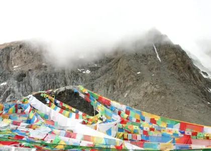
Kalapani is the Nepali territory.
In 2015, Nepal objected to the India-China object trade pact via Lipulekh. However, India titles Pankhagad, a small river on the southern part of Kalapani, as the border. Which somehow shows these areas are on their side. India generated new maps in 1879 AD, renaming the river flown from Limpyudhara. In conclusion, the Kali River to the river washed from Kalapani, a false statement India claimed according to the changing map in 1879.
They failed to assert their point as they hadn’t shown the actual border, the Kali River. However, disputes are not new. Time and again, table talks have been done. However, no conclusion was reached during each meeting, and no actions were taken in these sectors. But now, the triggering activities of road construction have made Nepal take these significant actions.
Importance of Lipulekh and Kalapani
Another vital reason behind this territory is its strategic importance.
Lipulekh, Kalapani, is a tri-junction of India, Nepal, and China. It is of geostrategic and geopolitical importance. It can monitor China’s remaining in that area. In the 1993 Indo-China War, these parts were given as a lease to support. They set up a camp in Limpyudhara for some time. During that time, they realized how important these areas are.
From the geo-economic point of view, it is the straight and shortest route from North India to Kailash Mansarovar.
Overview of the Geography of Nepal
Nepal, which lies between China and India, is a beautiful mountain country. It lies in South Asia, sharing borders with China in the North and India on all other sides (the south, east, and west). The total area of Nepal is 147,181 sq. km, and it manages approximately 28°N and 84°E. It falls in the temperate zone north of the Tropic Cancer. The total distance from east to west of Nepal is 800 km, whereas 150 to 250 from north to south.
The highest point in the country is Mt. Everest (8,848 m)
The lowest point is Jhapa (60 m), the Terai plains of Kechana Kalan.
Nepal is the second-largest country in terms of water resources—its vast water system flows towards southern India. Nepal is mainly divided into three central geographical regions: the Himalayan region, the Hilly region, and the Terai region. Nepali is the official language of Nepal, and most people speak it. Our official currency is the Nepalese Rupee (NPR).
Nepal is a country with cultural diversity consisting of more than 80 ethnic groups.
Nepal is a small mountain country.
Being a small mountain country yet possesses various world records factors, which is proud of Nepal. Besides these, the bravery of the Nepalese People has set an example for the world. They are ready to die to protect the motherland. Breathtaking beauty and cultural biodiversity are excellent factors that make Nepal stand out from other countries. Nepal is truly a gem for travelers.
Nepal is very popular because of its wide variety of flora and fauna and its holding of the rarest species. One-horned Rhinos, Red pandas, Bengal tigers, and the national flower, Rhododendron, are rare species in Nepal.
These articles will include facts about Nepal’s famous and intriguing factors that you must know.
Below is a list of interesting facts about Nepal, covering its people, culture, history, geography, and more.
Conclusion on New Map of Nepal
Most importantly, If you want to know the New map of Nepal in-depth, you should get out of your comfort zone and visit here. No one can fully know Nepal from only the written facts. Unless traveling in Nepal would make you realize what heaven is?
This article explores various interesting facts about Nepal that will genuinely surprise you in the best possible way. Visiting Nepal once is not enough.
Undoubtedly, Nepal is a sovereign country capable of making its own decisions. Growing up, we have always taught and heard that Nepal is a small country. This is because of its placement between two larger nations, India and China. This led us to believe in those statements. We aren’t, as we possess various world-record properties included in our country. And we are proud of this privileged factor. To think this is disrespectful towards our existence, our motherland, our constitution, and its sovereignty. It’s time to change our perspective and stand up for the truth for our nation.
Best Price Guaranteed, Easy to change Date, Instant Confirmation
Book This Trip Have Questions?
Talk to Expert
Meet Mr. Purushotam Timalsena (Puru), Nepal's best trek and tour organizer, who has been working in the Himalayas for more than 24 years.
WhatsApp/Viber +977 98510 95 800